Challenge
To understand urban growth in secondary Tanzanian cities as the basis for strategic and sustainable urban planning.
Solutions created by GAF
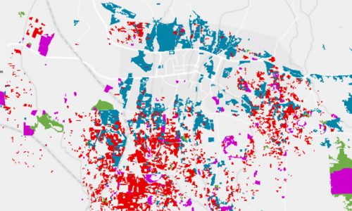
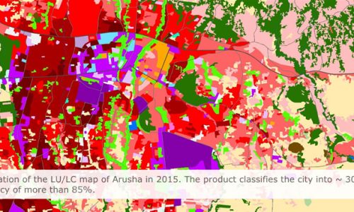
GAF created land use/land cover (LULC) maps showing 15 years of urban development in the Tanzanian cities of Arusha, Dodoma and Kigoma, based on very high and high-resolution satellite data provided by EO4SD-Urban to the World Bank project – “Tanzania Strategic Cities Project”.
These maps assisted with the analysis of existing urban master plans, current development, changes and trends. The map layers included:
- Transport infrastructure
- Urban extent and green areas
- Population distribution and density
- Informal settlements
Customer Benefits
- LULC maps enable analysis of city growth by visualising the geographical changes over time
- Development trends affecting specific urban locations can be identified
- New city master plans can be created based on up-to-date urban spatial analysis